Pacific Crest Trail in Washington
Pacific Crest Trail in Washington
The northern-most 10 miles of the Pacific Crest Trail in Washington, just south of the Canadian border, pass through the Pasayten Wilderness.
This short stretch, from Holman Pass to the top of Lakeview Ridge, is one of the most scenic sections of trail you’ll find anywhere.
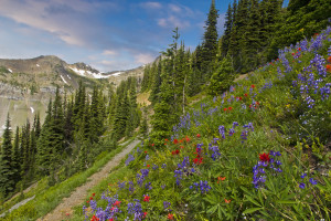
 Meadows, wildflowers, sharp ridges, endless views of peaks, solitude, and did I already mention wildflowers?
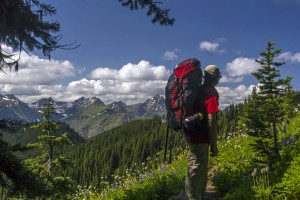
I have read that more than 95% of all thru hikers on the Pacific Crest Trail start at its southern end and hike north. The 2,400 mile sojourn covers many different types of terrain, from desert to foot hills to soaring peaks. Most often PCT thru hikers make it to the northern side of Washington in September or October, and so miss this explosion of colors.
The best time for a visit is mid to late July, into early August.
Assuming your NOT thru hiking the easiest way to get there is to drive your car north, from the town of Mazama (along Highway 20) past Harts Pass up to a junction with the PCT, just below Slate Peak. This link to the Okanogan National Forest page lets you see when the winter snow has melted so the road is open all the way up.
The trail junction with the PCT is well marked and there is some parking.
From the parking area head north, you will be starting your hike at a bit more than 7,000 feet elevation and its about 8 easy miles (mostly down) to Holman Pass.
From here the PCT makes a slow steady climb through forest and then up some switchback to your first of several magical spots.
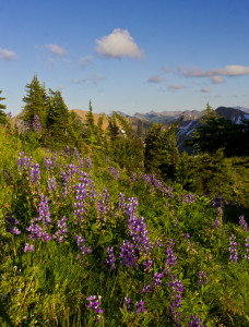
Here is a view of the meadows as you break out into the open.
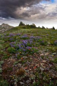
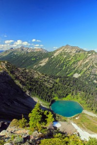
On the map you will see a spring marked along the trail, and a bit to the south tiny Goat Lakes. Surrounding you will be incredible meadows filled with all sorts of wildflowers. If you’re motivated, and who wouldn’t be, make the short cross-country jaunt up to see these two pristine lakes, and if you’re lucky, some goats!
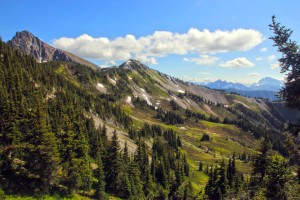
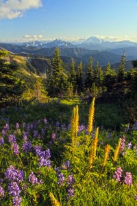
Powder and Shull Mountains, from the “Parade Grounds”
I was once told that this meadowy area was named the Parade Grounds, I don’t know if that’s correct, but the name seems like a good one to me. Shull Mountain dominates the view, with Powder Mountain rising to the north.
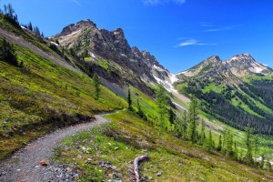
Continuing north, the trail ascends through more wonderful flower gardens towards Rock Pass.

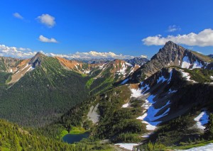
View north, from Rock Pass
The crest of the ridge is stunning, the views of the Rock Creek Basin spread before you, surrounded by Holman Peak to your right, with Powder Mtn. and Three Fools Peak anchoring the horizon…its a view you wont soon forget.This is one of my favorite views of the Pacific Crest Trail in Washington.
If you’d like to go on a North Cascades Photo Tour to this spot, let me know, in 2016 I will schedule Photo Tours to Rock Pass for 2 -6 people in late July. Here is the link for more details.
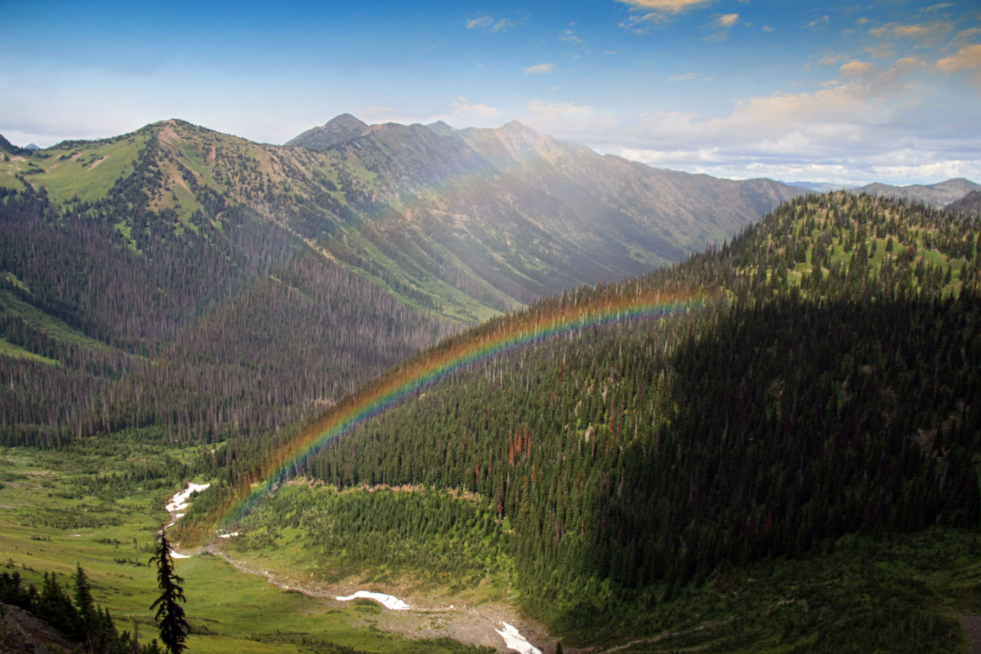
Rainbows at Rock Pass, Pacific Crest Trail
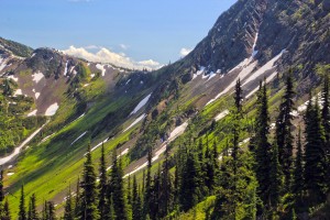
The trail plunges steeply down a few hundred feet to traverse below snow and scree fields along the north side of Powder Mountain, then you quickly regain that elevation as you climb up to the narrow notch of Woody Pass. Once through the gap the trail turns north , but now you are on the west side of the Cascade Crest. Views open up to include the Picket Range, to the southwest, while the snow cone of Mount Baker is visible in the distance.
-
- North side of Rock Pass
-
- On the PCT , just below Rock Pass, looking towards Woody Pass
The riot of flowers continues as the trail traverses along the west side of Three Fools Peak. Joker Mountain and Castle Peak dominate the views northward as you make your way along this glorious section of trail.
Curving around 2 finger ridges you make the last short ascent to the top of Lakeview Ridge, the highest point of the PCT in Washington. Snow often lingers in spots here until mid August, and so you can camp and enjoy this most awesome of spots, almost assuredly alone.
Wandering about the ridge top you can look down to Hopkins Lake below, the PCT plummets down the Devils Staircase to its shores. To the north east the wildness of the Pasayten stretches out, Cathedral Peak barely visible off in the distance. Three Fools Peak dominates the view south. To the west an endless sea of peaks stretch to the horizon.
View from Lakeview Ridge: Jack Mtn; left, Mt Baker; Center, My Shuksan; right
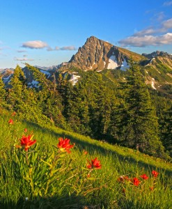
Three Fools Peak (right)
This is truly a magical place for camping and exploring.
If you’re of a mind, you can scamper down to Hopkins Lake for a swim, or make a jaunt further north, about 4 miles, past Castle Pass and the last 2.5 miles to the Canadian Border.